On July 9th, 1863, Confederate General John Hunt Morgan and his more than 2,000 cavalrymen met less than 500 "home guards" of the Indiana Legion just south of the town of Corydon in Harrison County, Indiana. Needless to say, Morgan's men carried the day and continued to push deeper into Union territory in what would become known as the longest cavalry raid of the Civil War.
The town of
Corydon holds a
reenactment celebration each year to commemorate this event, which also happens to be the last battle fought on Indiana soil, but due to our travels to Gettysburg we missed the 150th anniversary festivities. Nevertheless, I was determined to visit the site of the battle and get in some antique shopping!
Although the forecast threatened rain and storms, fantastic weather accompanied our trip westward on I-64 through Louisville and across the Ohio River into the Hoosier State. Once in Indiana, I elected to slip off the interstate and take in the scenery along State Road 11. It's definitely an indirect route to Corydon, but allows for a hilly, curvy driving experience that easily dispels the "flat" Indiana stereotype - not to mention passing along the point where Morgan's Confederates crossed the Ohio at Morvin's Landing.
 |
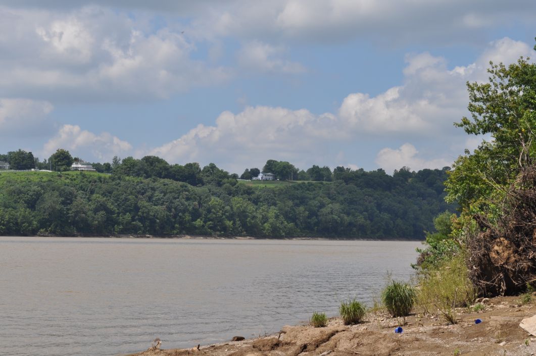
| View toward Brandenburg, KY from Morvin's Landing Road |
A day before the fight in Corydon, Morgan crossed the Ohio at this point by utilizing two captured steamboats. Men of the Indiana Legion attempted to oppose the crossing with musket fire and the rather ineffectual bombardment from one piece of artillery set atop a nearby ridge. A direct hit on the gun from one of the Confederate artillery pieces silenced the Federal cannon, killing its crew, and all opposition to the crossing faded away.
 |
| Brandenburg's Riverfront Park seen from Morvin's Landing |
Even though the Matthew E. Welsh bridge spans the Ohio a short distance downstream from Morvin's Landing, standing on the muddy bank of the river one can still get a sense of connecting with the events of that hot July day in 1863. The town of
Brandenburg, Kentucky, lies on the opposite shore and will most definitely be a stop for us on a future excursion.
 |
| Brandenburg homes overlooking the Ohio River |
State Route 135, the old Mauckport-Corydon road, lies just to the west of Morvin's Landing and was the route used by the main thrust of Morgan's invaders. The road in service today has been greatly "modernized", but the old road runs parallel at several points and offers a bit of a glimpse into the original scenery passed by the Confederate troopers. About 10 miles after joining Route 135 we turned off on Old SR 135 for the remainder of our trip to the battlefield site since the new road veers to the west of town.
Corydon Battle Park is a rather unassuming bit of land just outside the southern city limits on Old SR 135. You need a sharp eye to catch the entrance when approaching from the south, but a nice sized sign serves as an adequate guide when coming from the direction of Corydon. Fully wooded now, the five acres comprising the park was an open ridge where the small band of Union defenders positioned their artillery in the hopes of halting or delaying the Confederate invaders. The dense foliage thwarts any attempt to get a good feel for the terrain as it might have appeared to either the invaders or the defenders, unfortunately.
 |
| Replica Civil War cannon at Corydon Battle Park |
A replica cannon stands near the access road, as does a recovered mooring post and anchor chain from the steamboat
Alice Dean (sunk by Morgan after his cavalrymen reached the Indiana shore). A short, paved path takes visitors past a monument inscribed with the names of both the Union and Confederate men killed during the brief battle to a replica log cabin. The cabin was shuttered on our visit, but I from what I understand it serves as a sort of living history display on special occasions.
 |
| Anchor chain and mooring post from the Alice Dean |
I also expected to see a monument dedicated to Jeremiah Nance, one of the men killed manning the artillery piece at Morvin's Landing. He was buried at a farm cemetery just east of Laconia, but his grave marker was moved to the Battle Park in 1986 when the cemetery ceased to exist. At the time of our visit, his marker, and the iron fence that had been surrounding it, were completely gone. There was nothing to explain its whereabouts, so for now the situation is a bit mysterious.
 |
| Missing grave marker of Jeremiah Nance |
After a brief stay at the park we headed into Corydon for a bit of antiquing (the subject of a future post). The time available to us for exploration was severely limited due to having to be back home to take The Youngest to work. As a result, a number of spots that I had hoped to see had to be saved for our next visit to the area. Both
Indiana Caverns and
Squire Boone Caverns are in the immediate vicinity of Corydon, so there's at least one more trip on the horizon!
View some more photos in my
Flickr album.


